 |
 |
Kent Online Parish Clerks |
|
 |
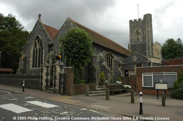 (Click photo for larger view) |
Thanet, St. Peter Parish |
|
|
|
Kent Online Parish Clerks |
|
|
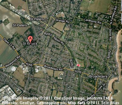
(Click photo for larger view) |
Thanet, St. Peter Parish |
|
 Click on map to view full size on Google Maps. |
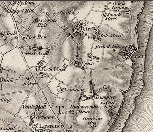
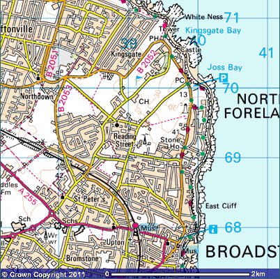 Click here for larger image of this 1881 survey. Click map for modern Ordnance survey map. Reproduced from Ordnance Survey map data by permission of Ordnance Survey, © Crown copyright. |
 We are sorry, there is no Online Parish Clerk for this parish. We are sorry, there is no Online Parish Clerk for this parish.We have no other information or data for this parish except what is accessed by or detailed on this page. If you wish to volunteer for this post or have data you wish to contribute, please use the appropriate link on our Contacts page. |
Statistical SummaryAcres: 3,312; of which 397 are waterOS co-ordinates: TR380684 Latitude: 51:21.9059N Longitude: 1:25.1101E Parish Church: St. Peter Registers commence: 1560 Other Denominations: St. Mary's Calvinistic Methodist Church St. Peter Baptist Markets: Monday - St. Nicholas at Wade Wednesday - Ramsgate Thursday - Sarre Friday - Minster Saturday - Monkton, Margate & Ramsgate Fairs: Palm Monday - Minster 30 May - Acol 13 July - Minster 22 July - Monkton 10 Aug - St. Lawrence 8 Sep - St. Nicholas at Wade 14 Oct - Sarre Newspapers: weekly at Ramsgate Electoral Place: Ramsgate Courts: Petty Sessions and County Courts - Margate and Ramsgate Jails: at St. Clement's, Sandwich |
Hospitals: Royal National at Westgate Amenities: Post office under Margate savings banks money order office Registration District: Thanet Poor Law Union: Thanet 1835-1930 Workhouse: Minster, Thanet Diocese: Canterbury Archdeaconry: Canterbury Deanery: Westbere Probate: pre-1859 - Archdeaconry Court of Canterbury post-1858 - Principal Probate Registry Lathe: St. Augustine Hundred: Ringslow Houses: 604.1 Parishes within 6 mile radius: Acol, Ash (Sandwich), Birchington, Chislet, Elmstone, Margate, Minster in Thanet, Monkton, Preston (Ash and Wingham), Ramsgate, Reculver, Sandwich (Sts Clement, Mary and Peter), Sarre, St Nicholas at Wade, Stonar, Stourmouth, Thanet St Lawrence |
 Domesday Reference: None Principal landholder: None |
Thanet, St. PeterThanet, St. Peter Parish, a village and a parish in Thanet district, Kent. The village stands on a pleasing eminence, 3/4 of a mile west-north-west of Broadstairs rail station, 1-1/2 southwest of the North Foreland, and 2 southeast of Margate; is a member of Dover cinque port. The parish contains also the chapelry of Broadstairs [see separate parish page], and the hamlets of Upton, Bromstone, East Dumpton, Fair Street, Westwood, Poor Hole, Sacketts Hill, Buddles, Shallows, Stone, Kingsgate, George Hill, Reading Street, Joss Street, Beards Hill, Callis Court, Callis Grange, Sole Street, Dane Court and parts of North Town, Northwood and Nash. Acres, 3,312; of which 397 are water. Real property in 1860, £19,474. Population in 1851 2,975; in 1861, 2,855. Houses, 604. The property is much subdivided; and there are many pleasant residences. The North Foreland is a prominent feature; and North Town hill is the highest ground in Thanet. Water works were constructed in 1859. The living is a vicarage in the diocese of Canterbury. Value, £540 with a habitable glebe house. Patron, the Archbishop of Canterbury. The church ranges from Norman to later English; comprises nave, aisles, and chancel, with West tower; and contains three brasses, monuments to the Dewkners and others, and a tablet to T. Sheridan, Esq.. The tower serves as a seamark, and shows two fissures caused by an earthquake in 1580; and the churchyard contains the grave of Richard Joy, the Kentish Sampson. The rectory of Broadstairs is a separate benefice. There are chapels for Baptists and Wesleyans, an endowed school with £30 a year, and charities £200. Old coins have been found in the cliffs; and a spermaceti whale, 61 feet long, came ashore in 1762. The living is a rectory in the diocese of Canterbury. Value £260. Patron, the Vicar of St. Peter. The church was built in 1828; and has a tower added in 1852. A Baptist chapel includes a portion of the old Lady chapel. There is also a Wesleyan chapel. Beards Hill, a hamlet in St. Peter's parish, Kent; 2 miles northeast of Ramsgate. Bromstone, or Bromston, a hamlet in St. Peter parish, Kent; near Broadstairs. Buddles, a hamlet in St. Peter parish, Kent; in Thanet, 2 miles north of Ramsgate. Callis Court, a hamlet in St. Peter parish, Thanet, Kent; 2 miles north of Ramsgate. Callis Grange, a tything in St. Peter parish, Thanet, Kent; 2 miles north of Ramsgate. Dane Court, a hamlet in St. Peter parish, Kent; 2 miles southeast of Margate. East Dumpton, a hamlet in the parishes of St. Lawrence and St. Peter, Kent; in Thanet district, 1 mile north of Ramsgate. Fair Street, a hamlet in St. Peter parish, Kent; 2 miles north of Ramsgate. George Hill, a hamlet in St. Peter-Thanet parish, Kent; 2 miles north of Ramsgate. Joss Street, a hamlet in St. Peter parish, Kent; near Margate. Kingsgate, a hamlet in St. Peter parish, Kent; on the coast, near the North Foreland, 3 miles East of Margate. It commands a pass or gate through the cliffs to the sea; it was originally called Bartholomew-Gate; and it took its present name from the landing at it, in 1683, of Charles II and the Duke of York. An actual gate, with portcullis, once guarded the pass but has completely disappeared. A mansion was built above the gate, toward the middle of last century, by Lord Holland, after the model of Cicero's Roman villa; and the grounds around it were studded with imitations of ancient buildings and ruins. The convent and the Castle, two of the most prominent of these buildings, have been converted into private residences. A coast guard station is at the hamlet. Nash, a hamlet in St. Peter parish, Kent; 1-1/2 mile south by east of Margate. Nash Court here belonged to the priors of Christ church, Canterbury; and passed to the Garwintons and others. Northwood, a hamlet in St. Peter and St. Lawrence parishes, Kent; 1 mile north of Ramsgate. Poor Hole, a hamlet in St. Peter parish, Kent; near Margate. Reading Street, a hamlet in St. Peter parish, Kent; 2 miles east-south-east of Margate. Sacketts Hill, a hamlet in St. Peter parish, Kent; 1-1/2 mile south of Margate. Shallows, a hamlet in St. Peter parish, Kent; near Margate. Sole Street, a hamlet in St. Peter parish, Kent; near Margate. Stone, a hamlet in St. Peter parish, Kent; near Margate. Upton, a hamlet in St. Peter parish, Kent; near Ramsgate. Westwood, a hamlet in St. Peter parish, Kent; 1 mile north of Ramsgate.1 1John Marius Wilson, comp. The Imperial Gazatteer of England and Wales. (London, England: A. Fullerton & Co., 1870). 2Edward Hasted, ed. and comp. The town and parish of Thanet St. Peter: Town and manors, The History and Topographical Survey of the County of Kent: Volume 4 (1798), pp. 260-307. 3William Page, 1861-1934, ed. The Victoria County History of Kent, vol. 3, p. 359.(London, England: The St. Catherine Press, Stamford Street, Waterloo, S.E., 1932). Thanet, St. Peter's Bibliography-- various. 'Archaeologia Cantiana'. Publisher: Kent, England: Kent Archaeological Society, various dates. [Note: The following volumes can be found on archive.org: 1, 2, 3, 4, 5, 6, 7, 8, 9, 10 (1876), 11, 12, 13 (1880), 14, 15, 16, 17, 18, 19, 20, 21, 22, 23, 24, 25, 26, 27, 32, 34, 35, vol. 1907 supplement.]
Great Britain, Public Record Office. 'Calendar of the patent rolls preserved in the Public Record Office--Edward II, Vol. 1. 1307-1313'Each volume has own index. Publisher: Genealogical Society of Utah d.b.a Historical Books on FamilySearch; http://www.familysearch.org. Great Britain, Public Record Office. 'Inquisitions and assessments relating to feudal aids : with other analogous documents preserved in the Public Record Office, A. D. 1284-1431', Vol. 3. Publisher: Genealogical Society of Utah d.b.a Historical Books on FamilySearch; http://www.familysearch.org. Great Britain, Exchequer. 'The book of fees commonly called testa de nevill, pt. 3'. The Book of fees contains information about the holdings of feudal tenants. Publisher: Genealogical Society of Utah d.b.a Historical Books on FamilySearch; http://www.familysearch.org. Hall, Hubert, 1857-1944. 'The Red book of the Exchequer - Liber rubeus de Scaccario, Vol. 3'. The Red book of the Exchequer was a register intended to preserve important documents comprising charters, statutes of the realm, public acts (Placita), private deeds and ordinances, correspondence. Publisher: Genealogical Society of Utah d.b.a Historical Books on FamilySearch; http://www.familysearch.org. Glencross, Reginald Morshead. 'Administrations in the Prerogative Court of Canterbury, Vol. 1. 1559-1571'. Publisher: Genealogical Society of Utah d.b.a Historical Books on FamilySearch; http://www.familysearch.org. Hasted, Edward. 'The History and Topographical Survey of the County of Kent; Containing the antient and present state of it, civil and ecclesiastical; collected from public records, and other authorities: illustrated with maps, views, antiquities, etc. The second edition, improved, corrected, and continued to the present time'. 12 volumes. Publisher: Canterbury: Printed by W. Bristow, 1797-1801. URL: British History Online Hussey, Arthur. 'Notes on the churches in the counties of Kent, Sussex, and Surrey, mentioned in Domesday book, and those of more recent date'. Publisher: London J.R. Smith,(1852). Letters, Dr. Samantha. 'Kent', Gazetteer of Markets and Fairs in England and Wales to 1516 (2005). URL: British History Online. Page, William, 1861-1934, ed.. 'The Victoria history of the county of Kent'. Publisher: London: Constable (1908). URL: British History Online Sharp, J. E. E. S., ed.. 'Inquisitions Post Mortem, Edward I, File 39', Calendar of Inquisitions Post Mortem, Volume 2: Edward I. Published:(1906), pp. 315-323. URL: British History Online. Sharp, J. E. E. S., ed.. 'Inquisitions Post Mortem, Henry III, File 45', Calendar of Inquisitions Post Mortem, Volume 1: Henry III. Published:(1904), pp. 296-302. URL: British History Online. Location of RecordsThe following list of records is not intended to be exhaustive. There are many records that are awaiting discovery in archive offices throughout Kent and England. This list is intended only to set out those records that are available via at least two relatively easy-to-access avenues. If you have used or discover a record that would be of benefit to other researchers, that is not on this list, please send me an email with the details of the archive - name, address and archival call number. Census
Church Records, Church of England
Church Records, Non-Conformist
Parish chest records
Workhouse and Poor Law Records
Land Records
Assizes and Sessions Records
|
| Record Type | Dates | Archives (Addresses) |
Corresponding LDS Family History Library film numbers (Find a centre near you) |
| Hearth tax | Currently under revision | ||
| Victuallers Recognizances | Currently under revision | ||
| Churchwarden's Presentments | Currently under revision | ||
| Parish rate books | Currently under revision |
| Record Type | Dates | Archives (Addresses) |
Corresponding LDS Family History Library film numbers (Find a centre near you) |
| Currently under revision | |||
Coming Soon
1801 - 1568
1811 - 1943
1821 - 2101
1831 - 2342
1841 - 2978
1851 - 2975
1861 - 2855
1871 - 3847
1881 - 4597
1891 - 5661
1901 - 7193
1911 - 10095
1921 - 15471 (est.)
London 62.2 mi.
Canterbury 12.2 mi.
Ashford 24.7 mi.
Bromley 56.5 mi.
Chatham 34.2 mi.
Cranbrook 38.7 mi.
Dartford 49.2 mi.
Deptford 59.3 mi.
Dover 16.1 mi.
Faversham 19.0 mi.
Folkestone 20.2 mi.
Gravesend 41.2 mi.
Greenwich 57.5 mi.
Hythe 22.5 mi.
Maidstone 35.0 mi.br>
Margate 3.1 mi.br>
Milton Regis 25.5 mi.
Queenborough 25.0 mi.
Ramsgate 4.7 mi.
Rochester 36.6 mi.
Sandwich 5.7 mi.
Sheerness 25.3 mi.
Tenterden 34.0 mi.
Tunbridge Wells 48.6 mi.
Woolwich 55.2 mi.
 |
Contact Us Privacy Policy Terms of Use |
© 2006-2015 Kent Online Parish Clerks, all rights reserved. No part of this page or web site may be reproduced either in part or in its' or their entirety in any manner whatsoever without prior written permission of Kent Online Parish Clerks or its' assigns or successors, as the case may be, and the author hereof. |
|